Showing posts with label geography. Show all posts

Saturday, August 27, 2011

How the States Got Their Shapes

We are home from another camping trip! I scheduled one post for our time away and then had trouble getting things in order for a post upon our return! We camped up on Lake Ontario at Fair Haven Beach State Park- a family favorite and it began and ended with severe weather including a "close" miss on an F2 tornado (which we would have certainly crossed paths with had we not delayed our departure that day and some too- close for- comfort lightning)! In between we had the earthquake and now we are wrapping up our wild weather week with a grazing from Hurricane Irene.  I have some great nature study to share with you from this trip. Look for it soon.

In the meantime, I wanted to share with you a book and accompanying TV show on the History Channel that maybe you have not seen. It's called How the States Got Their Shapes and it's based on the book with the same name by Mark Stein. The show was a special we caught one time while channel surfing and they ended up turning it into a series. This is a gem of a show! Run now to set your DVRs for this one. All of our kids enjoy it and the host, Brian Unger is pretty funny.

Since they keep quoting the author on the show, I finally sought to get the book at the library. So far E12 has read it and loved it and R11 is working on it now.


We record this show regularly now (along with the Price Is Right...don't ask!) and we love to watch it as a family. We learn lots of tidbits about the states and how they ended up with the borders they have. Some of them will surprise you!

Sunday, October 24, 2010

Trail Guide News

Some of you may know that we've been using the Trail Guides to US and World Geography for a while now. This year I decided to just work our way through the US Guide. The kids work on daily drills and will have mapping exercises or other geography quests on some days. We've always done geography as part of our unit studies, but the older kids especially like the daily geography work.

There are a lot of really good suggestions for projects in the trail guide that can be used for any geography focus. At the end there is a unit study on Lewis and Clark. I'm about to start a read aloud of The Captain's Dog based on this study.

Here R10 is working on a "signature map" where you write some state fact or name as the perimeter of the state. It was pretty cool when the kids were finished. Can you guess which state that is?


US Trail Guide


There are notebooking pages sold to go with this and the world study. I have the world study at two different levels, but I don't have any of the three (primary, intermediate, secondary) for the US. A must have is the Uncle Josh's Outline Maps. I prefer the CD which has extra maps. I just write out the assignments and occasionally I type them. I write out the mapping assignments on the back of the map they are to do. The kids have a small 1/2" binder with dividers where they keep all of their work.

Thursday, August 26, 2010

On the Way to the State Fair

E11's Truth about New York game is on it's way to the New York State Fair! Congratulations E11! (he had three entries in the county fair this year...which uhoh! I failed to report on this year...better take care of that. All three got blue ribbons, but the game got a State Fair purple ribbon!)

He created this game as an assignment of his choice during our study of The Little Red Lighthouse and The Great Gray Bridge. The original version of the game was really nice, but he figured that typing up the various cards and making them look more trim was a good bet.

He spent a lot of time redoing his cards on the computer after figuring out what he wanted and I helped him cover a mouse trap game box to house his game. He decorated everything with NY stickers. See the results of his hard work below.

The Box- He even put a picture of the set up game on the front. I purchased the stickers when I bought the Bare Books game things.

Check out the deed cards. The first ones were done by hand and this really sharpened up the game's image.

Don't these look nice? E11 remembered to give credit where credit is due and these were all from Wikimedia so the are public domain.

Really nice improvement cards. you can see the difference if you click on the original game.

Every thing looks tidy. E11 worked really hard on this game all tolled.
It displays at the State Fair this coming week. No matter how it does at fair, E11 can be really proud. He did his best work on this game. We are planning to take a trip up there mid-week to see how it does. This is the first time any of the kids have advanced on to state fair. E11 is pretty excited.

Saturday, August 14, 2010

Postcard Exchange 2010

About every other year or so we participate in the Five in a Row Postcard Exchange with other FIAR users. We put them up around our US map (though there are a few international cards usually) and enjoy looking them and some activities with them. This year we had some really fun home made cards (seems postcards are not readily available like they used to be). I think one of my favorites is the yellow maple card from Tennessee.

I think some postcards are still trickling in, but for the most part they are here and I'm planning to "Starting the New School Year" activities with them. Things like:
  • graphing how many cards we got from each state/country
  • pin pointing the location of each landmark/destination on our maps
  • researching some of the destinations we haven't heard of before to find out more
  • calculating distance between some of the locations
  • preparing a reasonable itinerary if we to travel and see the destinations
  • finding out which is the closest and furthest away from our home
When we are finished with the cards, we'll take them down and put them in the scrapbook we have full of postcards from previous exchanges. Right now they are in a small flip book, but I'm thinking of getting something bigger so all of them can fit in one big book for fun.

I'm in the preparation for school mode at the moment and you can see just a glimpse of our workboxes there under the map. This week I vacuumed them all out (dust and cobwebs gather there easily in a basement room) and I took out all of last year's schooling to be put away. Many notebooks stay assembled and we take the content from the previous year out if there isn't much room- like for math.

Anyone else try a postcard exchange? I highly recommend it if you can pull one off through an online community. Such fun!

Sunday, July 25, 2010

Compass Siting

While we were at Lake Ontario, Dan had a plan to take the kids out to site with their compasses. It was really super hot this week and being out on the breakwater pier in the bright morning or mid-day sun didn't sound like a good idea. Finally, the opportunity presented itself and they started out with walkie talkies. I hung at base camp (the playground) and kept in communication. Had to call the team back in from the outpost due to an impending storm. I heard the life guards clear the beach and said, "Away team time to bring it in! Beach is closed due to that thunder you hear..." The away team rogered that and headed back in.

The second attempt was made from a different point right on the beach and it worked out well!

First the kids chose the first two sitings they wanted to make. Then they took the first siting by holding up a compass and holding its arrow toward the siting they wanted to make. They twisted the top until the North marking was in the same direction as North on the compass.

After that they took their bearing- that's the direction the point is from where you are. Next was the back bearing which means the opposite direction as your bearing. They marked where the point was on their map and then turned the compass so that the back bearing was pointing the same direction as the arrow on the compass. Dan had marked the maps with the difference between north and magnetic north lines. So, the kids lined up the lines on the compass with the lines on the map and drew the line using the side of the compass. They knew they were somewhere along that line.

Then they took a second bearing using the other object they had chosen, took the back bearing and drew another line. Where they intersect is supposed to be where you are standing. But they decided to take a third bearing just to be sure and if the third line intersected then that would have been their position.

a close up of the final result

Turns out the third bearing revealed a problem with the second bearing- a set of bluffs along the shore. So, they figured out where they were and realized their position was where the first and third bearing intersected were accurate, but the bluffs/cliffs were not a good bearing.

I8 could hardly wait to try this!


The kids had a google satellite image of the shore area and drew in their lines. They all came pretty close to their exact location.

The kids had a GREAT time doing this...only a homeschool family would do this on vacation. Yes? There are more compass sitings planned for our next trip in a few weeks and this time the kids will do magnetic declination!

Sunday, March 14, 2010

Geography and Story Disks

So, each morning after we read aloud, we've been doing some Morning Meeting type items. Not be too school-ish, I'm not doing a whole laundry list of things. It's really a time for us to gather together to begin the written parts of our day. Mainly, we do the geography drill, find the Daily Quest for the day, and find out what we'll be focusing on for that day's academics.

Although I've always primarily done geography as part of FIAR, the kids asked for the geography drills and honestly they are enjoying them. Strictly speaking, the trail guides are meant to be used one book through from beginning to end either traveling the world or traveling the US. However, once the notebooks are established it really doesn't matter where you begin.

For example, I just reported that during the Civil War unit we were doing the New England states to start, but then we switched gears and started studying Angelo. So, we packed up and left for Europe. We went ahead and did a basic map of Italy for our study of Angelo (FIAR) and we began in northern Europe in the trail guide. As we do some books from other locations in the world, I'll keep moving along with the trail guide. I think it's too hard to skip around everyday or week, but I can switch continents pretty easily so we'll do that as much as we can. It's easy to switch as long as you switch at the end of a week and remember where you left off.

That's all in an effort to use the resource to my advantage not be a slave to it because it is "supposed" to be used in a particular way.

Below, I7 is working diligently on finding the prime meridian. He had to answer that question for his geography drill early last week. I have the notebook pages sold with the World Geography book. I like that the drills are already there for you, but sometimes I have a hard time matching a worksheet with the assignment in the book. I wish they were marked. Also, if you have a good source of outline maps (I think Uncle Josh's are the BEST) then you don't need to pay for all those great maps in the notebook set. I've been writing out the drills for the US, but hmmm....I guess I could type them all up too. Clever. Hadn't thought to do that until just now.


For each FIAR story on the first day when you discuss the setting/geography of the story, you have the kids place a "story disk" on the map. If you click below you can see a close up of a pigeon. Each story disk is a representation of the story which the kids put on the map. If it is a make-believe type story, then we use the border of the map as our "make-believe land". A story like Harold and the Purple Crayon would fall into that category.
Sometimes I find it hard to keep up with the story disks or I forget we have them. Volume 4 of FIAR comes with a laminated set in the back. I've lost so many in the past that I've made from the other volumes, that I'm tempted to purchase all of them already done for me!

Below we took the time to review and stick up all the volume 4 books we've done so far. All those in the margin are not make believe. They are older stories. When we complete a year, we also use the border to store those and clear the map.

Since you might have noticed we make up a lot of our own unit studies, we use squares for those studies and my kids make their own drawings of whatever we studied. In this case, I let them all choose how they wanted to depict the Civil War and put those "disks" where they happened in the US.
There are so many options for reviewing geography with your kids. I like how the trail guide reminds me of things other than just location and features of a place. Teaching my kids map skills and things like the Prime Meridian are important too and I don't have to make it all up all the time. Yes! It's true...sometimes I like it done for me.

Happy Trails!

Monday, February 15, 2010

Trail Guide to US Geography

Since we've been studying the Civil War and talking about states AND the kids really wanted to do some daily geography (what can I say? My kids LOVE maps), I thought it would be fun to pull a resource off the shelf- Trail Guide to US Geography.

During our Morning Gathering Time, the kids work on a two question geography drill using an atlas or whatever other resources they can come up with.

One day a week we do a mapping exercise with the current state.

Then there is a section of the book called Trail Blazing. Actually, each state has a Trail Blazing opportunity which consist of more indepth questions or a project of some sort.

What a perfect source for The Daily Quest! So, each day the kids find something in the box that will coincide with their skill level. The kids are having a lot of fun with it.

Sunday, November 1, 2009

World Map Fun

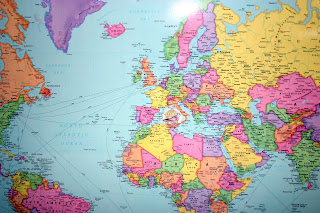
For years now, I've been buying disposable liner shower curtains from the dollar store. Yeah I know...totally NOT a green thing to do, but really I'm just not into keeping the shower curtain clean when, for a $1, I can replace it instead! They used to be a nice weight, but lately they've been super thin and not very effective at keeping water in the tub. Dan finally asked...when did the dollar store go cheap on us??

So, we're entering a new phase. The phase where I attempt to keep a shower liner clean. So, if I was going to buy a new, more permanent liner, I decided to go fun. The World Map.

This is meant to be an outer shower curtain, but since we have ONE bathroom for the six of us we have a dark outer curtain so that when there are potty emergencies during showers, there is a shred of hope for privacy for the person in the shower.

Instead we turned the curtain so the map can be read in the shower. It does a fine job of keeping water where it should be. Not so much at reducing time in the shower!

Thursday, May 21, 2009

Great Game!

Ok. I just want to say that this game plays really well. Your kids would enjoy it. I can't wait to get the world version. Throughout the game you have to answer geography questions as you travel around to different landmarks to get a card that reveals a henchman, a stolen item, or a warrant. In order to win you have to name the thing that was taken along with who took it and maybe where it is.

At the very end of the game you have to place all the capitals on the correct states in under a minute. Very cool. If you succeed then you catch Carmen. If not, she is free to roam and steal landmarks again.

Sunday, March 15, 2009

Checkin' Out North America

So, here is the first check-point in our time with the World Explorers. We had a great week.

We made a four part flap book on the Vikings along with a little reconstruction of a Viking long ship from that little Chick-fil-A craft book.

We recorded the route of Leif Erickson on our world map. I think we'll try to use different colored yarn for the different explorers. We'll mark their places of origin and their various destinations.

I puffy heart LOVE Google Earth!! It is the best globe ever!! I love to click on it and just move the earth around to see different views. It's just great when you go from one location to another. I love the way it flies you back out to space and zooms down again. So. Cool.

We hit North America on the geography trail since that is where the Vikings took us eventually.

I decided to purchase the Homeschool in the Woods New World Explorer hands on unit after all. It was just too tempting and we had a great time with the intro lesson on Friday using the free download.
We reviewed the seven continents, we talked about what an explorer is and why people explored. It was a fun lesson.

Good news! After being mailed out Friday, I received the CD on explorers yesterday and that means no more stalling...we're gonna groove right along. Tip- I ordered it from The Old Schoolhouse so I could skip the tax and shipping.

Wednesday, March 11, 2009

World Exploration- A Unit Study

I am using the list of explorers in the Ultimate Geography and Timeline Guide as a place to get started. We'll incorporate some elements of a unit study on maps and navigation from the November/December issue of The Old Schoolhouse Magazine. Plus, in true FIAR style, we'll be reviewing some of the titles we've rowed that go along with our theme. I wanted to make sure we hit the explorers this year and the kid's voted on it being our next unit last week. So, here we go!


This will provide us with some fun activities as we find out what the land was like where our explorers traveled.

These two are a great reference for historical time frames and the explorers themselves in some cases. We used the maps today to mark the route of the Vikings.

New to us this year- I bought volume 3 of Story of the World so I could use the read aloud portion of the curriculum. I hope to get a few activities based on exploration out of it as well.

We'll be doing some work on navigation and mapping. This little Discovery Channel book I picked up at our little consignment shop. It'll be fun to listen to the Jim Weisse CD on explorers.

We'll be making a modified version of the Viking warship- I'll give a shout out to my sister in law for giving me a stack of Chick-fil-A books. Great crafts in there and we have some other civilizations as well. Too bad we don't have a Chick-fil-A of our own around here...

Great deals on Columbus resources. Love picking titles like this up at our consignment shop and the library sale.

Last but not least, I'll be using the History Pocket resources for our notebooking- after our Native American unit I am not eager to start another official History Pocket giant construction paper notebook. I'm going for using the papers in a simple 3-pronged folder. Don't tell Evan Moor I've had it with the pockets!

Kendra introduced me to the Homeschool in the Woods History Time Traveler unit on explorers. Wow. This is tempting. Check out the sample download from the unit and you'll see what I mean!

Google Earth Lessons - a great resource for using Google Earth as a teaching tool

Google Earth Lesson on Sir Frances Drake's circumnavigation of the world

I sure hope you all have investigated Google Earth. It is crazy awesome to work with and so exciting to use with kids. In fact, they love it so much they choose it if they are given free time on the computer. So fun!

I will be sure to update you as we go along. Come and join us in the journey!

Wednesday, March 4, 2009

Maps and Map Sources

This is my favorite source for outline maps. I just added to our collection in the late summer and I've used it here and there for our mapping needs. I also reverted back to my standbys in a pinch. This afternoon I pulled out the CD to print some maps for tomorrow and took some time to browse the CD for a bit. All I can say is - wow!

This has all the outline maps you can imagine for the US and around the world. It has color relief maps, color political maps, black outline maps, all kinds of maps of regions and states, the world, ancient maps, just a crazy lot of maps! I bought my copy at Rainbow Resource. They do have a book of the masters, but there are extras on the CD. I also ran across a driveway map that is in beta testing, but I haven't had the time to explore that one yet.


Other fun products from the same company which we use:

Ultimate Timeline and Geography Guide- this is a neat study of geography using history and literature. It has lots of outline maps in it and all kinds of ideas. Just an all around fun resource!

Trail Guide to US Geography

Trail Guide to World Geography

We have used these resources to follow along with our FIAR studies and to take journeys now and then outside of the unit study. Very soon we are embarking on a journey of exploration and we'll be using the trail guides a lot more.

Where else can you find maps?

Enchanted Learning - if you pay the membership, you can get the maps full size without words. So worth it!

Scholastic Outline Maps- I used this one for the first year or more we homeschooled.

abcteach- There are membership benefits on this site as well

edhelper.com - I haven't explored this one a whole lot for maps, but I did see that they have them.

Thursday, November 13, 2008

Our Favorite Atlases

Do you have a favorite family atlas? I thought I would share our favorites. E10 is the kind of guy that loves to pour over atlases and incidentally almanacs. One Christmas I insisted on getting a US Road Atlas and an almanac from that year. Dan thought I was being ridiculous. I'm here to tell you that they were two of his favorite gifts that year. I wonder when it's time to get him a current one??

Without further mumbling...our favorites are the National Geographic World and US Atlases for Young Explorers. I like the way they have icons in the map for showing industry and natural resources. Plus, the map depicts the topography really well.

Please excuse the blogging indiscretion. Yes, those are my legs. Back a few weeks ago actually when I could still wear jeans. Hmmm...I wonder how long post-op before I can wear my jeans again...


I waited on the World Atlas for about a year and a half before I finally succumbed. It is the newer addition.

I have a real thing for satellite and physical maps! So pleasing to the visual learner.

Thursday, October 2, 2008

Trail Guide to World Geography

I mentioned when they arrived that we are trying out the Trail Guides to US and World Geography this year. We are starting with the World edition and just started this week. We've added this to the beginning of the school day and the kids are pretty excited about it. In addition to a daily drill they do a mapping activity of some sort and then one "trail blazing" activity which is a hands on event per week. This week the plan is to demonstrate the distortion of a globe by using a balloon and seeing how the writing changes as it gets blown up. Kinda cool.

Below are the trail guides to the US and World plus the Ultimate Geography and Timeline Guide. The ultimate guide is pretty cool for a general reference throughout the grades and it has a nice chart on the explorers which is great since I'm making up that unit myself. Between these and the CD-ROM of Uncle Josh's Outline Maps we are in good shape map wise.

This week's mapping activity is the world- they had to label each continent and the equator at 0 degrees latitude. Today E10 also added the Artic and Antartic Circle. I found out I'd started him this week on the high school level thinking it was intermediate. He's disappointed to drop back a level so I guess I'll have to throw some of those drills in on occasion.
The notebook has 9 sections. One for each continent, one for geographical terms, and one for the world. The kids are learning new mapping skills and have been eager to chase after a fact so far. Hopefully it won't wear off! When we get to our explorers unit, these new skills will come in handy and I think will add a lot to our studies. I did purchase the notebooking pages to go with it out of sheer convenience. I think R8 will do much better with the structure. We'll update of course!
Posted by Picasa