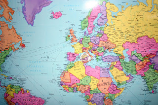
Although I've always primarily done geography as part of FIAR, the kids asked for the geography drills and honestly they are enjoying them. Strictly speaking, the trail guides are meant to be used one book through from beginning to end either traveling the world or traveling the US. However, once the notebooks are established it really doesn't matter where you begin.
For example, I just reported that during the Civil War unit we were doing the New England states to start, but then we switched gears and started studying Angelo. So, we packed up and left for Europe. We went ahead and did a basic map of Italy for our study of Angelo (FIAR) and we began in northern Europe in the trail guide. As we do some books from other locations in the world, I'll keep moving along with the trail guide. I think it's too hard to skip around everyday or week, but I can switch continents pretty easily so we'll do that as much as we can. It's easy to switch as long as you switch at the end of a week and remember where you left off.
That's all in an effort to use the resource to my advantage not be a slave to it because it is "supposed" to be used in a particular way.
Below, I7 is working diligently on finding the prime meridian. He had to answer that question for his geography drill early last week. I have the notebook pages sold with the World Geography book. I like that the drills are already there for you, but sometimes I have a hard time matching a worksheet with the assignment in the book. I wish they were marked. Also, if you have a good source of outline maps (I think Uncle Josh's are the BEST) then you don't need to pay for all those great maps in the notebook set. I've been writing out the drills for the US, but hmmm....I guess I could type them all up too. Clever. Hadn't thought to do that until just now.

For each FIAR story on the first day when you discuss the setting/geography of the story, you have the kids place a "story disk" on the map. If you click below you can see a close up of a pigeon. Each story disk is a representation of the story which the kids put on the map. If it is a make-believe type story, then we use the border of the map as our "make-believe land". A story like Harold and the Purple Crayon would fall into that category.
 Sometimes I find it hard to keep up with the story disks or I forget we have them. Volume 4 of FIAR comes with a laminated set in the back. I've lost so many in the past that I've made from the other volumes, that I'm tempted to purchase all of them already done for me!
Below we took the time to review and stick up all the volume 4 books we've done so far. All those in the margin are not make believe. They are older stories. When we complete a year, we also use the border to store those and clear the map.
Since you might have noticed we make up a lot of our own unit studies, we use squares for those studies and my kids make their own drawings of whatever we studied. In this case, I let them all choose how they wanted to depict the Civil War and put those "disks" where they happened in the US.
 There are so many options for reviewing geography with your kids. I like how the trail guide reminds me of things other than just location and features of a place. Teaching my kids map skills and things like the Prime Meridian are important too and I don't have to make it all up all the time. Yes! It's true...sometimes I like it done for me.
Happy Trails!

1 comment:
This is great Heather! We just started using Trail Guides. I only have the U.S. Trail Guides now but I am planning on getting Trail Guides for the world soon.
Post a Comment