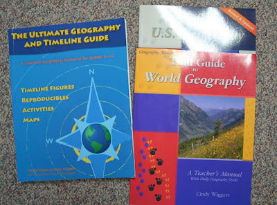
Below are the trail guides to the US and World plus the Ultimate Geography and Timeline Guide. The ultimate guide is pretty cool for a general reference throughout the grades and it has a nice chart on the explorers which is great since I'm making up that unit myself. Between these and the CD-ROM of Uncle Josh's Outline Maps we are in good shape map wise.

This week's mapping activity is the world- they had to label each continent and the equator at 0 degrees latitude. Today E10 also added the Artic and Antartic Circle. I found out I'd started him this week on the high school level thinking it was intermediate. He's disappointed to drop back a level so I guess I'll have to throw some of those drills in on occasion.

The notebook has 9 sections. One for each continent, one for geographical terms, and one for the world. The kids are learning new mapping skills and have been eager to chase after a fact so far. Hopefully it won't wear off! When we get to our explorers unit, these new skills will come in handy and I think will add a lot to our studies. I did purchase the notebooking pages to go with it out of sheer convenience. I think R8 will do much better with the structure. We'll update of course!


3 comments:
Wow, that was so over my head! lol.
You rock as a homeschoolin mama though! kudos to you! :D
That looks really great! Hope it keeps working for you guys!
Heather - HOW do you keep up with MOPS, FIAR, BY FIAR, And Trail Guides, and The handbook of Nature study green challenge, nature studies, scrapbooking, etc etc!! You must be super charged! I have the trail guide - I bought it last summer at a used curr. sale, but alas. It is just sitting.....You go!
Post a Comment